More details & pictures posted on wikiloc.
https://www.wikiloc.com/hiking-trails/yibir-caves-loop-hike-fujairah-112535131
My Non Commercial and Non Profit Hiking Community friendly personal FB Page dedicated to UAE Hiking information and Trails.
https://www.facebook.com/Patricks-Hikes-101251445547970
Yibir Caves to Nihad village Mayya Loop Hike. Fujairah.
Trail Stats:
| Distance: | 9 kms |
| Difficulty: | Moderate |
| Elevation gain: | 521 m |
| Elevation loss: | 521 m |
| Max elevation: | 810 m |
| Min elevation: | 310 m |
| Trail type: | Loop |
| Moving time: | 5 hours 10 minutes |
Yibir Caves to Nihad village Mayya Loop Hike. Fujairah.
This hike was organised by Shan of UAE Weekend Lovers group.
I had read about the caves in Yibir mountain section for quite some time, and was interested to see them. Thankfully our friend Shan organised this hike.
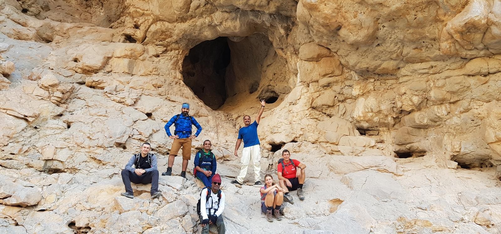
These small caves are situated in the Wadi section at the base of Yibir mountain towards West. They are not much deep and we saw some bats in one of them.
The best place to park your cars is near this mountain base village named Mayya.
Please note that this is a functional village and you need to be discreet while approaching the village and park the cars properly without blocking the road or property.
You may have to drive on little graded road surface, but sedans can manage this section.
25.609827, 56.117254
https://goo.gl/maps/7Duhq8k8wctnp5yp6
The trail initially is a nice walk through the Wadi with small boulders which soon become bigger and the terrain becomes more beautiful with different formations on the mountain walls and also the Wadi boulders themselves.
You could also use this trail only for a beginner hike until the caves and then return back with a decent amount of elevation gain and bouldering navigation activity.
It would be about 4 kms one way hike with about 150 meters elevation gain.
This section will be a good experience for newbies to learn bouldering.
Hiking gloves will be beneficial.
At about 4 kms from the start point, you will see the small caves in the right side of the wadi. They are not very big or deep. but interesting and feel hot from the inside.
We continued further to view few more caves and then decided to reach the summit village named Nihad above in this area.
This section needs good amount of scrambling and bare hands climbing on fairly stable mountain surface with good grip.
Still care needs to be taken while navigating this section for good footing and stable hand grip.
Our ascent from the Wadi to the mountain top surface is quite steep, but you gain this elevation quickly as it is faster to gain elevation in vertical sections.
Once you are on the top, you can have nice views of Khatt mountain section, Mebrah / Yibir summit and the base village too. Ain alsheriyah section is also visible.
Bit far is the Nihad village where you can have a nice break. It looked occupied with new houses although we didnt see any residents.
In any case, please do not cross into any property or misuse the area.
From this village, there is a obvious donkey trail all the way down to the village where we parked the cars. The trail is not well laid but it is visible.
The descent is quite steep on the trail but you can manage well.
Please take care on loose rocks in this section and look for a good footing while descending. Hiking poles will be beneficial.
You can see the village very well while descending and the parking spot.
Overall this hike is an enduring one and there are lots of options to extending the hike upwards until the plateau of the Yibir mountain, but best left to the cooler days.
Parking Location:
Grade: Moderate
Base Village: Wadi Taween
Range: Jebel Mebrah.
Download:


Trail

Trail

Trail

Village

Village

Trail

Trail.
Leave a Reply