Trail Stats:
| Distance: | 13 kms |
| Difficulty: | Moderate |
| Elevation gain: | 1300 m |
| Elevation loss: | 1300 m |
| Max elevation: | 1400 m |
| Min elevation: | 251 m |
| Trail type: | Out and Back |
| Moving time: | 5 hours 18 minutes |
The Trail starts in Wadi Litibah. The last section of approach road is bit rocky and large pebbles, so a good clearance vehicle is required. Many hikers park their vehicles at Wadi Ghalilah Dam parking and walk about 3 kms to the Trail head. 4WD or AWD vehicle is an advantage although good clearance Sedan also can manage the graded road.
The Hike Start point is here.
You need a 4X4 to reach here as the 3 Kms Offroad from the Asphalt road is rough and full of pebbles.
https://goo.gl/maps/sJNHGHyrVwL9cyNz7
The Sedan Car Parking near Wadi Ghalilah Dam here.
https://goo.gl/maps/rjwhsTmfEtXaQKkU8
The below link is the Trail recorded as the Offroad section from Wadi Ghalilah to Hike start point.
https://www.wikiloc.com/offroading-trails/ghalilah-dam-to-sth-trailhead-82793544
This Hike is also known as Woh Village Hike ( false name ), but the Village at the summit of this trail is known as Ras al Ghash.
The Trail is well marked by its path, there are no Painted Flags or Trail marker stones. The path is very clear and visible as the farmers and the hikers have been using this trail regularly.
We took about 4 hours to reach the summit taking well deserved breaks at every Stone bench Resting stations.
We carried more than 4.5 Liters of water and other Nutrients.
Once you reach the Trail head, you simply follow the path, some steps, some ups and downs etc and the trail takes you through through the short Balcony walk and then to a dried Water fall and then later to the summit via a steep loose rocks path and then by some man made stairs to the Summit.
In between, you will get to rest on Stone table and benches in about 4 places.
The midpoint of this hike is the dry waterfall with a small pond, just after a long fenced balcony walk. It is one the popular spots on this hike.
The trail is well maintained and well visible. You can not get lost unless you want to.
The Ras al Ghash village on the summit is simply beautiful with farms and goats.
The farmers are friendly too.
While descending down, take care as the long distance and steep slope will take toll on your knees and ankles. A hiking pole is advantageous.
Best to start early in the morning so that you get maximum shade from Sun and longer daylight to enjoy and explore the hike.
Take minimum 4 Liters of water, suitable Hiking shoes, Head lamps and batteries and snacks.
As we reached heights, the weather changed immensely for the better and at the top village the weather was around 22 deg Centigrade.
We took a long break at the summit, had a good Nap and had a nice Tea with the Farm hands of the Village.
On our way back, we collected as much Trash ( water bottles and Cans ) that we could gather and carry.
It was heartening to see Hikers without common sense throwing away the Trash on the mountain instead of disposing them off in a proper manner.
The group should be small and led by an experienced Hiker who knows the area and who managed the Safety aspects. Lights, Water, food, Electrolytes and other important topics should be considered and followed strictly.
Parking Location:
Grade: Moderate
Base Village: Wadi Litibah
Range: Jebel Jais, Wadi Litibah, Wadi Ghalilah.
Download:

Stone staircase.

The dry waterfall.

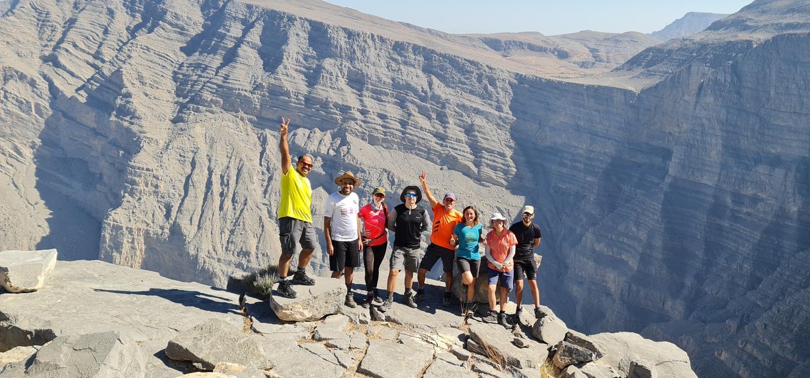
Summit point pose.

One of the shelters.

Summit point pose

With the landlord of Ras al Ghash village.

At the start of the trail

With friends at the topmost stairs


Leave a Reply