More details & pictures posted on wikiloc.
https://www.wikiloc.com/hiking-trails/pietrosul-rodnei-mountain-summit-hike-in-borsa-romania-carpathian-range-40079606
My Non Commercial and Non Profit Hiking Community friendly personal FB Page dedicated to UAE Hiking information and Trails.
https://www.facebook.com/Patricks-Hikes-101251445547970
Pietrosul Rodnei (Muntii Rodnei) Summit Hike in Borsa, Romania. (Carpathian Range)
Trail Stats:
| Distance: | 17.5 kms |
| Difficulty: | Moderate |
| Elevation gain: | 1320 m |
| Elevation loss: | 1320 m |
| Max elevation: | 2300 m |
| Min elevation: | 900 m |
| Trail type: | Out and Back |
| Moving time: | 6 hours 30 min |
Pietrosul Rodnei (Muntii Rodnei) Summit Hike in Borsa, Romania. (Carpathian Range)
Overview
Pietrosul Rodnei Mountain Summit Hike in Romania.
There is no entrance fee for this hike or for the Rodnei National Park.
More pictures in my facebook account album.
https://www.facebook.com/media/set/?vanity=vijaydsilva1&set=a.10218236124321773
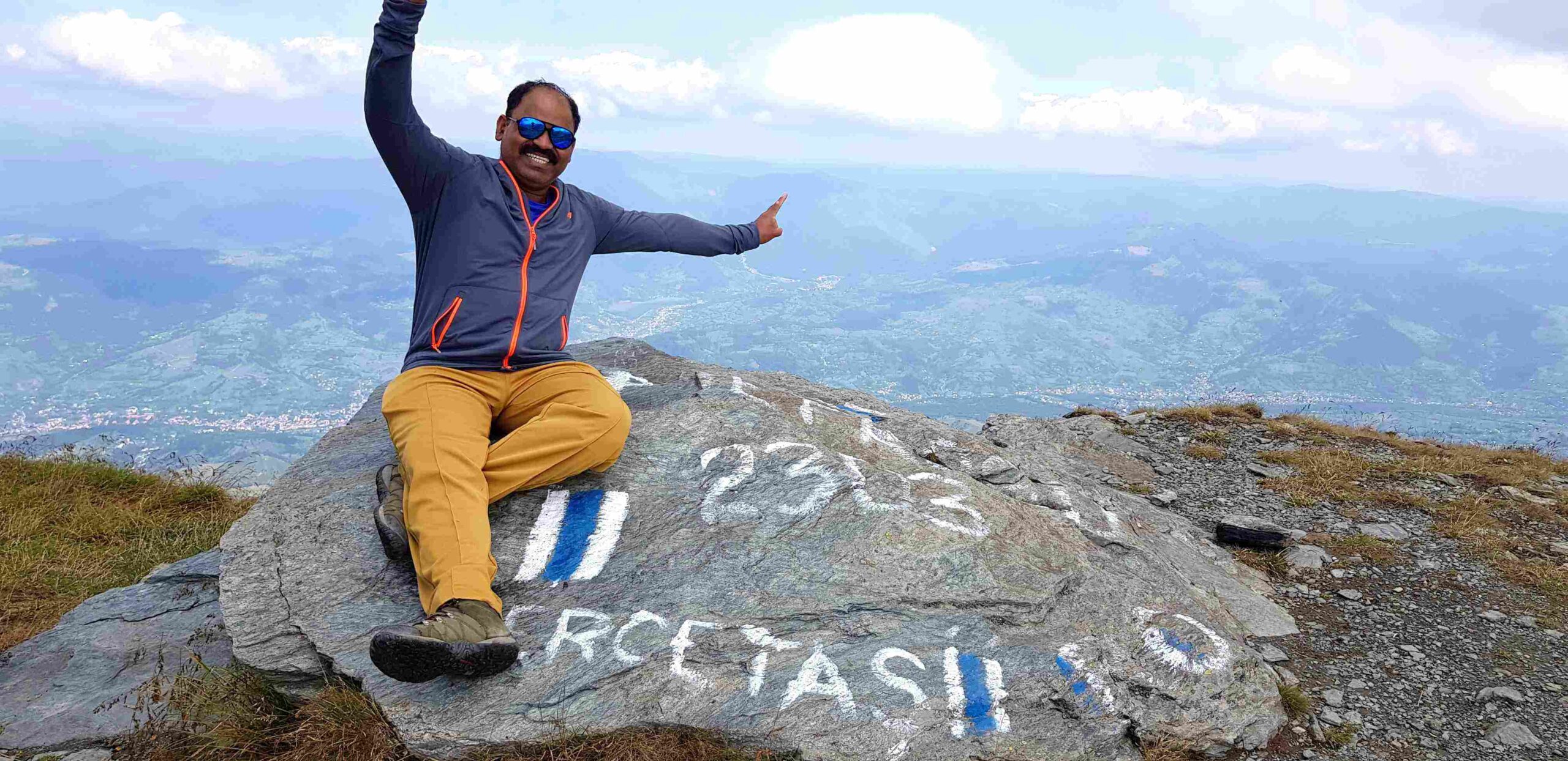
So here I am, at last completed the hike in Romania.
I had one of the best hike of my life today.
Pietrosul Peak is the highest mountain peak in the Rodna Mountains with 2,303 meters. It is also the highest peak in the entire chain of the Eastern Carpathians, being divided between Maramureș and Bistrița Năsăud counties.
The Rodnei National Park offers hikes for all levels of difficulty and the view is something that will impress you. The most famous and tallest peak in the area, Pietrosul Rodnei, has a height of 2303 meters and gives an open view of the surrounding mountains and valleys as it is the first landform in the chain.
As we were driving across Romania for 2 weeks, I had reserved this day only for hiking in Borsa town.
It took 31,000 Steps and 18 Kms distance to climb up and down. And that was the shorter version of this mountain hike !!!
Apparently Pietrosul means Rocky. This is very much a Rocky mountain with some greenery on it.
I was more worried about the Bears as I was aware that Romanian mountains are popular for Bears. Apparently there are no bears in this area. Good news.
I parked the Car near the Monastery and started the walk by myself alone.
https://maps.app.goo.gl/1D75exX8hJ1Nxmg79
From the parking lot where you have left the car, you need to start ascending on the dirt road following the ba.gif blue tape markings. The hike is totally manageable for anyone until reaching the Meteorological Weather Station located at about 2000m. This part of the road has a length of about 4.5 kilometers and an altitude gain of 800 meters and it should take you roughly 2 hours to do.
Further up on the slope you will find a lot of raspberry and bluberry along the road (depending on the time of year, of course). The best tasting raspberries I have eaten in my life so far! Beware, picking the berries can slow down your pace considerably. Bears also love it, bear this in mind (on the other hand, normally they try to avoid meeting humans if they hear them coming, so talking is generally considered as good “self-defence”).
Almost 70% of the Trail path is a Offroad track that was built for the Weather station construction and their Employees to travel. Still it is being used for the purpose.
The terrain is Rocky, but good enough to walk in the Middle of the Greenery.
Initially I didnt find anyone on the way. Then later I met a few Local Romanians hiking the same trail, so befriended them and had their company all the way to the Summit.
We had nice breakfast at the Weather station with few shots of Palinca at 9 am !!!
The hike route is clearly marked.
Continue on the footpath going close to Lezer Lake and start the steep ascent to the mountaintop. As you gain altitude and leave the lake behind Lezer will start resembling more and more like the map of Romania.
The trail continues along the creek and passes by Lake Iezer. On the 13th January, 1944, a group of 16 young Hungarian men from Salgótarján were hit here by an avalanche – only one of them survived. A memorial was erected in 2003 by the lake to remember the victims. Another memorial by the lakeshore remembers Rodrigo Nemeş, who also got caught by an avalanche.
Soon after the memorial, the trail starts winding up the steep northeast face of Pietrosu. When you reach the saddle, the path bifurcates in two directions (both marked by blue stripe). The one to the south continues towards Buhăescu Mare (dropping down to Curmătura Pietrosului saddle, with the Buhăescu Lakes below to the east). The branch to the west is a short side-trail, leading up to the summit of Pietrosu. From here it is about 10 min to the summit. The whole ascent from Borşa takes about 6 hours.
The path does not present any difficult parts as it constantly zig-zags until the top. You should reach the saddle in approximately 1 and a half hours, where you need to do a right turn and continue to the peak that shouldn’t take more than 30 minutes.
The final ascent is made on rock carved stairs that make it even easier. Enjoy the view and have a well-earned rest.
Once you reach the Weather Station at 1,700 meters, then it is a long steep Zigzag trail path that goes all the way to the Summit at 2303 METERS.
There is a Old Soldiers cabin at the Summit which was used by Soviet Soldiers.
The weather was good today as compared to yesterday’s rain.
Overall I feel very good, proud and TIRED and ACHING BODY.
You can find fresh water sources along the way, one at the start of the hike, one midway and the last at Iezer Lake but take notice that some of these spring might dry up during the summer season. As such I recommend you pack a good supply of fresh water for the trip.
Though the mountain can be climbed all year, in winter there is usually severe avalanche danger on the steeper slopes (in Pietrosul’s case, north). Several lives have been claimed so far, so take the warning serious! There is no avalanche forecast service.
Phone numbers for Salvamont (Romanian mountain rescue service):
– National Salvamont dispatcher: 0-SALVAMONT (0725826668)
How to get to Pietrosul Rodnei Peak?
To get to Maramures from Timisoara, you have a long way ahead consisting of more than 500 km of roads that doesn’t include motorways. This will take, on average, about 8 hours so plan your trip accordingly as the roads are not in the best condition in Maramures (the rest of the road is pretty good).
Your destination is the city of Borsa that lies at the footsteps of Pietrosul Peak, but to get here you need to follow road E671 from Timisoara in the direction of Arad, Oradea, Satu Mare. From here you will continue on DN19F until Apa, then switch to E58 until the city of Baia Mare. Continue on DN18 through Sighetu Marmatiei and all the way to Borsa.
In Borsa, from the main road, you will have to do a right turn at the hospital and continue on this road for 2 more kilometers after passing Borsa Turism Camping. The asphalt transforms into a dirt road, but it is totally manageable by any car until you reach a small parking place located where the path splits in two, one way goes up the mountain (road is closed and only manageable by heavy-duty off-road vehicles) and one way goes to a small monastery. Park the car here and go the rest of the way by foot.
Parking Location:
Grade: Moderate
Base Village: Borsa
Range: Muntii Rodneii
Download:

Metrology station

Lake

Summit

Base view of summit


Old Soldiers Bunker

Trail

Trail.


Leave a Reply