Jebel Yibir and Jebel Harf Tila Summits: UAE Flag Day 2024 Hike.
There was no flag at the summits, I carried my own UAE Flag.
Join my non-commercial Facebook page, “Patrick’s Hikes”!
Get updates on past and upcoming hikes.
https://www.facebook.com/Patricks-Hikes-101251445547970
If you followed my trail, referred my detailed text and if it helped you in achieving your goal or not, Kindly leave a comment / review on wikiloc post after your hike.
It will be helpful for fellow hikers to understand the trail and your inputs will be appreciated.
Trail Stats:
| Distance: | 20 kms |
| Difficulty: | Moderate |
| Elevation gain: | 813 m |
| Elevation loss: | 813 m |
| Max elevation: | 1535 m |
| Min elevation: | 1244 m |
| Trail type: | Out and Back |
| Moving time: | 5 hours 35 minutes |
Generally people call the Mebrah mountain as Yibir, as it is drivable with a military installation on its summit and this summit is not accessible to the general public.
This trail recorded as one way till the summits of real Jebel Yibir and Jebel Harf Tila.
You could return back the same way.

Jebel Yibir mountain peak at about 1500 meters above sea level is one of the seven top peaks in UAE.
This peak is an independent peak within UAE with no sharing borderline with Oman such as Yabana, Harf Tila and Tafif mountains.
The other tall independent peaks of UAE within the borderline (above 1300 meters elevation) are Jebel Raharah, Rahabah and Qadaah.
To hike this trail, you need to drive all the way to the top of Mebrah / Yibir mountain in Taween area.
The last section of about 6 Kms road is very steep and need a strong car.
The access road to the top of Mebrah mountain is recently reconstructed and of very good quality. You need a strong car to drive up and down due to steep road.
On the way, towards the top there is a RAK military gate. The guard will take car and EID details before allowing you in.
The permission to enter is purely to their discretion.
We parked here and started our hike.
25.649070, 56.121293
https://maps.app.goo.gl/6S1RemWPMcCYhH9M8
Within 150 meters of following your walk from the parking, you will be on a well visible established trail that will take you towards Durdur village in the left side and you walk further on the trail all the way.
In the midway, you will also see Jebel Yibir in the left side, there is no trail to go to its peak, its bit rough.
Please follow this trail, at about 3 kms point the trail turns left downwards to the base of Ybir.
Soon the trail continues towards Kanan village.
We took left connection with no visible trail and soon we were on stable ground with rocky terrain.
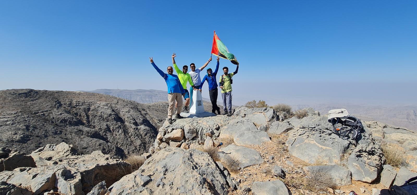
Once you are on the top, there are 3 summits that are false summits and you will reach the real Yibir summit of 1500 meters on the 4th high point.
You will also see a concrete foundation laid on the summit with a marker number on it.
From the summit, you have impressive views of Musandam peninsula mountains, Jebel Harf Tila, jebel Qihwi, Jebel Qadaah, Jebel Mebrah, Tallah Comstel tower, Kanan village, Wabsaqar the lower village of Durdur and Samarat etc.
Then we descended back the same way to the trail and then continued towards Jebel Harf Tila.
We continued on the trail all the way and soon we got the view of Double peaked Jebel Harf Tila in front of us.
Soon we reached the base of the summit section.
The trail continues to the Sili village at bit lower elevation.
We took rightwards to the summit on the mountain surface without any trail and soon reached the summit section of Harf Tila at 1582 meters elevation.
Very scenic hike that goes on well established, stable and visible paths walked for centuries by mountain communities.
This trail that we hiked is about 90% is on a well visible safe trail.
The last push to the Harf Tila summit is bit rough with no trail, but with stable terrain of soil and rocks.
There are 3 routes to reach Jebel Harf Tila.
Below I am sharing the routes and trails on wikiloc.
1. From Wadi Naqab, Sheri village, Samarat farmlands and Harf Tila.
https://www.wikiloc.com/hiking-trails/wadi-naqab-jebel-half-tila-twin-brothers-summit-96263909
2. From Wadi Taween, Sidaqa village, few more villages and Harf Tila.
https://www.wikiloc.com/hiking-trails/w2w-trail2-wadi-taween-to-wadi-naqab-via-jebel-half-tila-89285277
This is a longer one way route, but you could reach the summit and return back to avoid logistics.
3. From Yibir (Mebrah) mountain via Durdur village and Harf Tila.
This present trail. The easiest one with much lesser elevation gain and on safer visible well made trails.
You also have occasional viewpoints to view Dibba Musandam areas occasionally.
This is the ONLY peak in UAE from where you can see all the 7 tallest peaks of UAE.
1. Jebel Jais.
2. Jebel Rahabah.
3. Jebel Qadaah.
4. Jebel Yabana.
5. Jebel Yibir.
6. Jebel Tafif / Surem / Salli
7. Jebel Harf Tila
Once you have enjoyed your great views after the hard climb, you can return back the same way.
Parking Location:
Grade: Moderate
Base Village: Mebrah Durdur village. Jebel Yibir
Range: Jebel Yibir. Jebel Harf Tila
Download:

View of The Yibir mountain range

Jebel Yibir summit, Ras al Khaimah, UAE

Beautiful sunrise

Jebel Yibir summit

The well marked trail

Harf Tila in the background

Harf Tila Mountain, Ras al Khaimah, UAE

Jebel Yibir summit view


Leave a Reply