My Non Commercial and Non Profit Hiking Community friendly personal FB Page dedicated to UAE Hiking information and Trails.
https://www.facebook.com/Patricks-Hikes-101251445547970
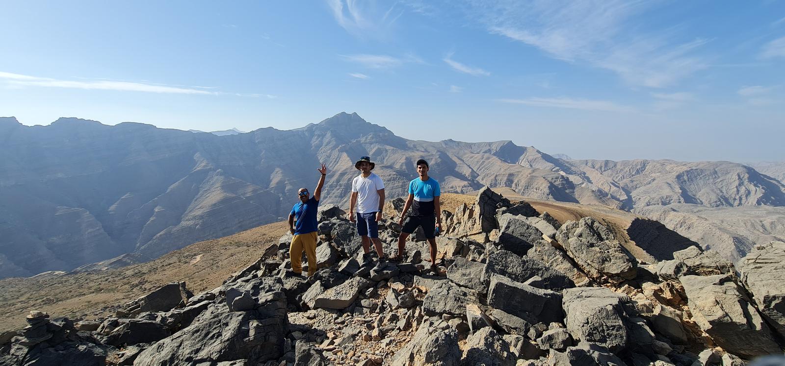
Jebel Raharah Summit to Wadi Lahsa Descent via Hidden Oasis
Trail Stats:
| Distance: | 10.5 kms |
| Difficulty: | Moderate |
| Elevation gain: | 120 m |
| Elevation loss: | 1300 m |
| Max elevation: | 1730 m |
| Min elevation: | 400 m |
| Trail type: | One way |
| Moving time: | 3 hours 30 minutes |
Jebel Raharah Summit to Wadi Lahsa Descent via Hidden Oasis
This trail was recorded as a segment of a larger and longer loop hike.
This trail is recorded as a descent from Jebel Raharah to Wadi Lahsa, but the purpose of this post is to get guidance to hike to Raharah summit from Wadi Lahsa as an ascent plan.
So you will have to use this trail in reverse mode.
To hike this trail as one way needs bit of understanding of local navigations and logistics plan.
Also please note that there is no public parking spot to park the cars close to Raharah summit if planning to hike this as one way trail.
The nearest public spot to park is at the last parking area of Jais road higher section, closer to the Jais sledder.
https://maps.app.goo.gl/yrximZKKmHoJPGGMA
25.943094, 56.141793
The parking spot at the lower section of this trail of Wadi Lahsa is here.
https://maps.app.goo.gl/WzYPEinDataDTMin7
25.907281, 56.140399
Most of this whole hike is on a well established trail which is mainly part of Highlander events. We bypassed the trail in the middle to connect to the Shahha village over a mountain surface.
There is the longest balcony section in the UAE too, views are grand.
We descended from Raharah using the highlander trail and then connected to the Shahha village. From Shahha we descended to Hidden Oasis and then ended the hike at Wadi Lahsa.
Parking Location:
Grade: Moderate
Base Village: Wadi Shah
Range: Jais.
Download:

Wassab Summit

Haqeel Fields

Trail.

Terrain.

Trail.

Trail

Stairs Trail

Stairs Trail.


Leave a Reply