More details & pictures posted on wikiloc.
https://www.wikiloc.com/hiking-trails/uae-54-jebel-hafeet-hike-al-ain-242239583
My Non Commercial and Non Profit Hiking Community friendly personal FB Page dedicated to UAE Hiking information and Trails.
https://www.facebook.com/Patricks-Hikes-101251445547970
Jebel Hafeet Hike. Al Ain.
Trail Stats:
| Distance: | 8 kms |
| Difficulty: | Moderate |
| Elevation gain: | 525 m |
| Elevation loss: | 525 m |
| Max elevation: | 800 m |
| Min elevation: | 290 m |
| Trail type: | Out and back. |
| Moving time: | 2 hours 30 minutes |
Jebel Hafeet Hike. Al Ain.
I visited this trail after exactly 6 years and this year we hiked up and down unlike last time we hiked up one way by planning cars.
The trail itself is not a marked trail, you can see traces of well walked route most of the time. You just find your way and walk on your comfort zone terrain. There are no markers or directions. At few places there are white painted pointers.
This Hike starts from the Green Mubazzara park at the foot of Jebel Hafeet to all the way up till the Phone tower.
The starting point is somewhere here.
You may have to park the car in designated parking closeby
https://maps.app.goo.gl/kB1gRjHmUEJUiY4d7
24.100727, 55.749455
Not a difficult one, you can take your own time to do it.
The terrain is bit rough, please be attentive while hiking and keep your hands free at all times.
This trail has 3 parts.
Lower part of the Wadi is sandy and standard rocks etc.
Middle section is steep with loose rocks and some climbs etc, need good attention and stable footing.
Upper section is solid and stable terrain where you have better hiking experience.
The terrain is more like fossil rocks, hollow and can be brittle.
Please be careful on these solid looking rocks, which are mostly hollow from the downside. Stay away from the ledges and corners of the rocks and they can simply break away and you losing your balance.
There is no shade whatsoever.
Please pay attention while stepping on edges as the rocks may be hollow from beneath.
You could also park spare car on the top Parking at the endpoint of this hike ( Restaurant car park ) and make it one way Hike as we did few years ago.
https://maps.app.goo.gl/rZrcis2gF1YJaR6B6
24.083968, 55.764518
Please take all care and precautions for a safe hike.
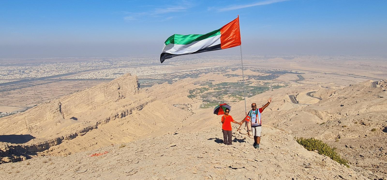
This is a straightforward and easily navigable trail, offering panoramic city views on one side and a backdrop of majestic mountains on the other. Ideal for sunrise hikes along the seaside or sunset adventures overlooking the mountains, this trail features a manageable incline, making it perfect for cardio workouts.
Remember to bring an ample supply of water, and please help maintain the trail’s cleanliness, avoiding the unfortunate fate suffered by many others.
Accessible by any car, the initial rough path can be negotiated even by sedans, ensuring convenient parking at the trailhead. Once on the trail, various paths may unfold before you, yet rest assured that regardless of your chosen route, you will ultimately converge at the same point when completing the entire loop.
Disclaimer:
𝘿𝙤 𝙉𝙤𝙩 𝙏𝙧𝙮 𝘼𝙣𝙮 𝙃𝙞𝙠𝙚𝙨 𝙄𝙛 𝙔𝙤𝙪 𝘿𝙤 𝙉𝙤𝙩 𝙐𝙣𝙙𝙚𝙧𝙨𝙩𝙖𝙣𝙙 𝙏𝙝𝙚 𝙈𝙤𝙪𝙣𝙩𝙖𝙞𝙣 𝙏𝙚𝙧𝙧𝙖𝙞𝙣𝙨, 𝘿𝙖𝙣𝙜𝙚𝙧𝙨 𝙁𝙧𝙤𝙢 𝙒𝙞𝙡𝙙𝙡𝙞𝙛𝙚, 𝙁𝙞𝙧𝙨𝙩 𝘼𝙞𝙙, 𝙃𝙮𝙙𝙧𝙖𝙩𝙞𝙤𝙣 𝘼𝙣𝙙 𝙎𝙣𝙖𝙘𝙠𝙨, 𝙔𝙤𝙪𝙧 𝙊𝙬𝙣 𝙁𝙞𝙩𝙣𝙚𝙨𝙨, 𝙍𝙚𝙢𝙤𝙩𝙚 𝘼𝙘𝙩𝙞𝙫𝙞𝙩𝙮 𝙋𝙧𝙚𝙥𝙖𝙧𝙖𝙩𝙞𝙤𝙣𝙨, 𝘾𝙤𝙢𝙢𝙪𝙣𝙞𝙘𝙖𝙩𝙞𝙤𝙣 𝙏𝙤𝙤𝙡𝙨, 𝙈𝙤𝙪𝙣𝙩𝙖𝙞𝙣 𝙂𝙚𝙤𝙜𝙧𝙖𝙥𝙝𝙮, 𝙏𝙤𝙥𝙤𝙜𝙧𝙖𝙥𝙝𝙮, 𝙍𝙞𝙨𝙠 𝙁𝙖𝙘𝙩𝙤𝙧𝙨, 𝙃𝙎𝙀 𝙍𝙚𝙦𝙪𝙞𝙧𝙚𝙢𝙚𝙣𝙩𝙨, 𝙃𝙞𝙠𝙞𝙣𝙜 𝙍𝙞𝙨𝙠𝙨, 𝙁𝙞𝙩𝙣𝙚𝙨𝙨 𝙇𝙚𝙫𝙚𝙡 𝙊𝙛 𝙏𝙝𝙚 𝙂𝙧𝙤𝙪𝙥 𝙈𝙚𝙢𝙗𝙚𝙧𝙨.
𝙎𝙩𝙪𝙙𝙮 𝘼𝙡𝙡 𝘼𝙗𝙤𝙫𝙚 𝙈𝙖𝙩𝙩𝙚𝙧𝙨 𝙒𝙚𝙡𝙡 𝘽𝙚𝙛𝙤𝙧𝙚 𝙁𝙤𝙡𝙡𝙤𝙬𝙞𝙣𝙜 𝘼𝙣𝙮 𝙏𝙧𝙖𝙞𝙡𝙨 𝙏𝙝𝙖𝙩 𝙔𝙤𝙪 𝙁𝙞𝙣𝙙 𝙊𝙣𝙡𝙞𝙣𝙚. 𝙋𝙡𝙚𝙖𝙨𝙚 𝘿𝙤 𝙉𝙤𝙩 𝙊𝙫𝙚𝙧 𝙀𝙨𝙩𝙞𝙢𝙖𝙩𝙚 𝙔𝙤𝙪𝙧𝙨𝙚𝙡𝙛. 𝘽𝙚𝙩𝙩𝙚𝙧 𝘽𝙚 𝙎𝙖𝙛𝙚 𝙏𝙝𝙖𝙣 𝙋𝙪𝙩 𝙔𝙤𝙪𝙧𝙨𝙚𝙡𝙛 / 𝙂𝙧𝙤𝙪𝙥 𝙄𝙣 𝘿𝙖𝙣𝙜𝙚𝙧 𝘼𝙣𝙙 𝙍𝙚𝙜𝙧𝙚𝙩 𝙇𝙖𝙩𝙚𝙧. 𝙇𝙖𝙩𝙚𝙡𝙮 𝙒𝙚 𝙃𝙖𝙫𝙚 𝙎𝙚𝙚𝙣 𝘼 𝙇𝙤𝙩 𝙊𝙛 𝙐𝙣𝙬𝙖𝙣𝙩𝙚𝙙 𝙃𝙞𝙠𝙞𝙣𝙜 𝙄𝙣𝙘𝙞𝙙𝙚𝙣𝙩𝙨 𝙏𝙝𝙖𝙩 𝘾𝙤𝙪𝙡𝙙 𝙃𝙖𝙫𝙚 𝘽𝙚𝙚𝙣 𝘼𝙫𝙤𝙞𝙙𝙚𝙙 𝙒𝙞𝙩𝙝 𝘽𝙚𝙩𝙩𝙚𝙧 𝙋𝙧𝙚𝙥𝙖𝙧𝙖𝙩𝙞𝙤𝙣.
𝙒𝙞𝙠𝙞𝙡𝙤𝙘 𝙞𝙨 𝙊𝙣𝙡𝙮 𝙁𝙤𝙧 𝙍𝙚𝙛𝙚𝙧𝙚𝙣𝙘𝙚. 𝙏𝙝𝙚𝙧𝙚 𝘾𝙖𝙣 𝘽𝙚 𝙀𝙧𝙧𝙤𝙧𝙨 𝙊𝙣 𝙏𝙝𝙚 𝙂𝙋𝙎 𝙍𝙚𝙘𝙤𝙧𝙙𝙞𝙣𝙜.
Waypoints
Parking Location:
Grade: Moderate
Base Village: Green Mubazzara
Range: Hafeet.
Download:


Ghayl Dam

Trail

Trail

Dam

Village

Trail

Trail.


Leave a Reply