My Non Commercial and Non Profit Hiking Community friendly personal FB Page dedicated to UAE Hiking information and Trails.
https://www.facebook.com/Patricks-Hikes-101251445547970
Jais road – Highlander- Wassab village (one way)
Trail Stats:
| Distance: | 13.6 kms |
| Difficulty: | Moderate |
| Elevation gain: | 1392 m |
| Elevation loss: | 650 m |
| Max elevation: | 1400 m |
| Min elevation: | 238 m |
| Trail type: | One way |
| Moving time: | 4 hours 30 minutes |
Jais road – Highlander- Wassab village (one way)
Enjoyed your hike using my detailed instructions?
Please share the love by leaving a comment or review on the Wikiloc post!
Your feedback helps fellow adventurers discover and navigate the trail with confidence.
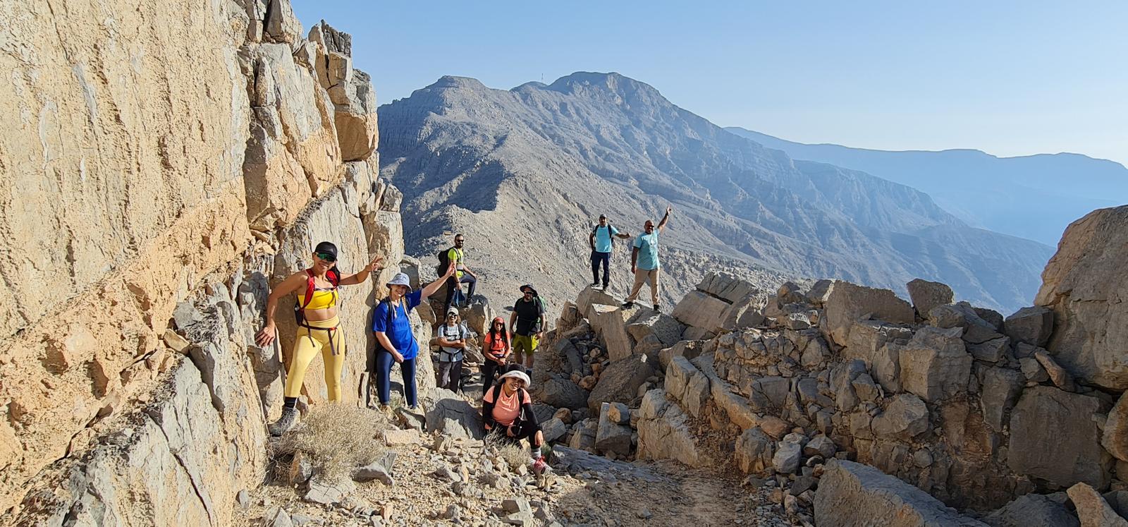
Ras al Khaimah authorities have recently laid a brand new trail on the Jebel Jais road to link the asphalted road to the Highlander trail above the Haqeel plateau. So we decided to explore this route and then extend the hike as possible.
The start point of this hike is here, where you have enough space to park your cars.
https://maps.app.goo.gl/B2PveKFP3GMAYfpn9
25.876226, 56.100300
The new ascent trail section is about 2 Kms link section till it connects to the Highlander.
The trail is well laid, safe and well visible.
This trail gains about 550 meters of height over a short distance of 2 Kms.
There is a rest shelter at the midpoint and one more at the top junction point with Highlander trail.
The views from this summit are excellent of the Arabian Gulf coastline, Haqeel plateau, RAK town, Rams area, Mangroves and Most of RAK mountains.
From here, we hiked rightwards from the summit junction all the way to Jebel Rahabah using the Highlander trail and then we descended to Wassab village and further to Jebel Jais view point #3 parking, effectively making it a one way hike.
As you are aware, the Highlander trail is excellently created with visibility, thousands of rocky stairs and a path on a terrain that would seem impossible to be laid.
The trail is wavy on the plateau, but as you reach the walls of Rahabah mountain, the climb becomes steep with stairs, all the time safe.
No exposed areas though.
From the high point of Jebel Rahabah, we descended into Wassab village using the Highlander UAE laid escape rote and further reached the Jais road viewing area car park #3.
As this was one way hike, we had parked cars at both ends.
Please note that the driving distance between both start and end point is about 20 minutes.
Using this trail you can hike various options.
You could also hike up this trail and end the hike at Jais view deck park.
You could also hike our trail and then descend into the Nayt village trail and further to Ghazla area, which is the start point of Samar trail..
Most of these above options are one way hikes and will need vehicle logistics to be arranged.
—————————————————————————————–
This trail below shows the full recording of Highlander 2022 in anticlockwise fashion.
https://www.wikiloc.com/hiking-trails/uae-51-highlander-2022-1-day-hike-120113416
We could effectively divide the UAE Highlander 2022/23 trail into 4 segments as their start / end points have escape routes to the Jebel Jais road.
These individual segments can be actually hiked over 4 schedules to hike at leisure, but the issue will be car management as these will be one way routes.
Based on escape trails, I have divided the main 37 Kms trail of Highlander into 4 segments in clockwise fashion.
1. Jais road near Haqeel to Naqat area on Jais road.
The trail is about 11 Kms long, the road connection trail to Naqat is 2 Kms long.
https://www.wikiloc.com/hiking-trails/highlander-2022-23-lower-segment-reverse-ras-al-khaimah-182292239
The start point and end point driving / parking distance is about 3.5 Kms.
2. Naqat area (Jais road) to Parking #3 on upper Jais road.
The initial road connection trail of 3 Kms, The Highlander segment of 6.5 Kms and then the Jais road connection via Wassab village of 5 Kms.
https://www.wikiloc.com/hiking-trails/jais-road-highlander-jebel-rahabah-wassab-village-one-way-162123882
The start point and end point driving / parking distance is about 18 Kms.
3. Jais road / Wassab connection trail of 5 Kms till Highlander segment of 5.5 Kms till the Jais view deck park.
https://www.wikiloc.com/hiking-trails/jais-road-wassab-village-jebel-rahabah-view-deck-park-119938074
The start point and end point driving / parking distance is about 5 Kms.
4. Jais View deck park to Highlander segment all the way till observation deck via Ghaf summit trail then descend all the way down to Wadi Lahsa via Musaibat village.
Total of 16 Kms.
This will be the longest and enduring hike and the car management will need 20 minutes of driving each way. The start point and end point driving / parking distance is about 15 Kms.
Please use this trail as recorded but in reverse and pls remove the Jais true summit section hike.
https://www.wikiloc.com/hiking-trails/uae-52-lahsa-jais-summit-view-deck-park-hike-via-hl22-route-154673603
Parking Location:
Grade: Moderate
Base Village: Wadi Shah
Range: Jais.
Download:

Wassab Summit

Haqeel Fields

Trail.

Terrain.

Trail.

Trail

Stairs Trail

Stairs Trail.


Leave a Reply