More details & pictures posted on wikiloc.
https://www.wikiloc.com/hiking-trails/costa-rica-volcano-miravalles-guayabo-112014992
My Non Commercial and Non Profit Hiking Community friendly personal FB Page dedicated to UAE Hiking information and Trails.
https://www.facebook.com/Patricks-Hikes-101251445547970
Costa Rica: Volcano Miravalles, Guayabo.
Trail Stats:
| Distance: | 13 kms |
| Difficulty: | Moderate |
| Elevation gain: | 1350 m |
| Elevation loss: | 1350 m |
| Max elevation: | 2000 m |
| Min elevation: | 650 m |
| Trail type: | Out and Back |
| Moving time: | 6 hours 30 min |
Costa Rica: Volcano Miravalles, Guayabo.
Overview
The Miravalles Volcano hike near Guayabo, Costa Rica, offers a unique adventure through lush landscapes and geothermal wonders. This dormant volcano, located in the Guanacaste province, is surrounded by tropical dry forests and geothermal fields. The hike typically starts in open pastures and ascends steeply into dense cloud forests, providing breathtaking views of the Pacific Ocean and Lake Nicaragua along the way.
The trail is known for its challenging terrain, including steep climbs and unmarked paths, making it advisable to have a guide. Along the way, you’ll encounter diverse flora and fauna, including ancient vines and colorful butterflies. At the summit, you’ll be rewarded with stunning views and a glimpse into the crater, which is partially obscured by vegetation.
Miravalles Volcano is a located in Costa Rica at the Guanacaste province, 21 Kilometers away from Liberia.
At its peak there are up to 6 volcanic craters, with 5 being aligned with NE-SE direction, the highest peak is 2028 meters above sea level.
Miravalles Volano has an elevation on 2028 metres and its last explosion was on 1946.
On Miravalles, the Instituto Costarricense de Electricidad developed the Miravalles Geothermal Project, which produces electricity based on steam heat generated by the volcano.
The Miravalles volcano is sourrounded by the Miravalles Forest Reserve, a terrain of 108.5 square kilometers of protected area.
The trail head starts from the house of Freddy Soto, the guide, at the beginning of the path in Guayabo village.
Our hike started at around 8 in the morning.
The first kilometer is pure pasture, alongside there is forest or rows of trees, which allows you to walk in the shade for much of this route. Several fences are crossed, cows and a stream are seen, many stones buried in the ground.
In this part there are slopes that already show what the rest of the path will be like, although with less intensity. Also, by looking back, you have an idea of what the views will be like at later viewpoints.
Upon entering the forest, the canopy of trees prevents so much wind from entering the forest, and it seems like a completely different place.
Entering the forest also means entering the Miravalles Volcano National Park, there are still no offices, booths, not even park rangers, if there is a sign indicating the limit of the NP.
At this point the guide told us that the path is well marked, not long after, the mango slope begins.
Shortly after kilometer 2 there is a deviation towards viewpoint 1, or Miriador las Rocas. It is worth visiting because it is very close to the main path.
Along the trail there are some clearings that remind us of the windy reality of the place. Towards kilometer 3 or 4 there is a water intake. The hill doesn’t let up, if something gets more intense and the flat parts last no more than seconds and the descents only serve to remind you that an even steeper hill follows, keeping the pace becomes an exhausting task.
The trail is not only very clear, it is marked with signs that indicate either the direction of the trail or some characteristic of the place or of a tree and deviations. Fallen trees can be seen very often but the path is not lost.
At kilometer 5 you reach viewpoint 2, it corresponds to another path that instead of going through the forest, goes through a savannah, this route was taken on the descent. It can be said that it is similar to viewpoint 1, but being higher up, you have a better view.
At this point the path is still clear, but instead of a dirt floor it becomes a mud pool, there are also clouds and strong winds that penetrate the forest, some climbs are not achieved with just the feet and it becomes almost a climb in small sections, the cold becomes evident and amplified by the wind and the drizzle.
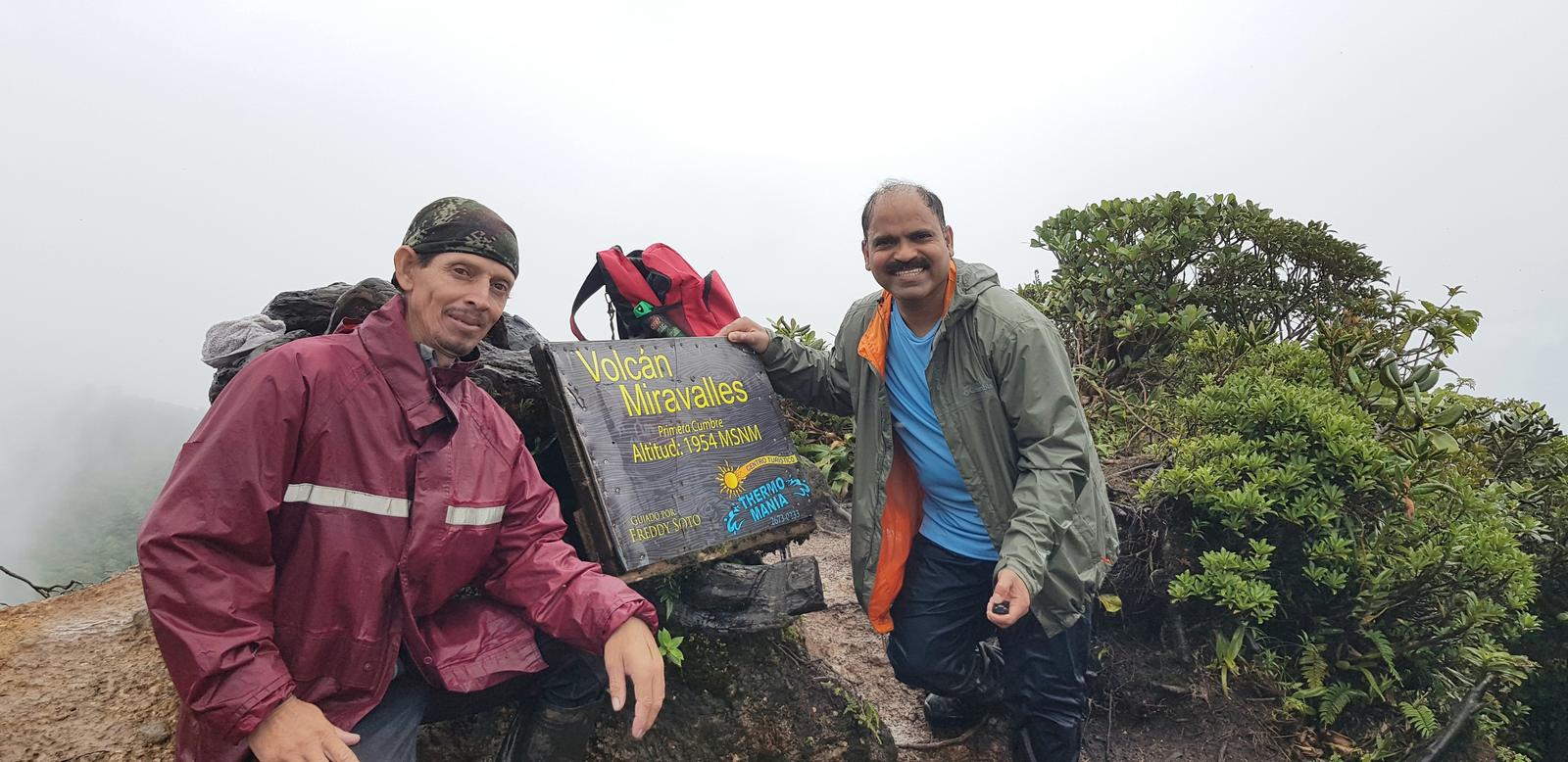
The first peak was reached in approximately 2 hours 15 minutes, here at least 3 different height data can be seen, the data on the cartographic sheets is 1959 meters, this place gives the impression of an end since it is indeed a peak , however the path continues, it becomes more difficult, so much so that it is named path of the brave, one is welcomed with a descent down a rock, provided with a rope to hold on. You can see cliffs that lead to the crater and mud is everywhere, the place is very humid, care must be taken in this section because the wind blows very strongly, what I would recommend is to walk crouched in the most dangerous areas. present, for example a step on a log that is slippery and a wrong step could have consequences. It was another 15 minutes to reach the second top.
As we were told, there is a third summit where there is a milestone and it is the maximum height of the volcano, and thus the maximum height of the province of Guanacaste. Recommended route but definitely not as a first route, it should be taken into account that the slope is steep for most of the way and at the end it is a muddy path.
This route passes through a private farm and you must contact the owner and guide Freddy Soto to coordinate the walk. Thanks to the guide and group of walkers for this beautiful walk. Top 3 is pending for another occasion.
Parking Location:
Grade: Moderate
Base Village: Guiyabo
Range: Miravalles
Download:

Grand Views

Trail

Trail

Trail


Grasslands

Trail

Trail.
Leave a Reply