More pictures in this post on wikiloc.
https://www.wikiloc.com/hiking-trails/qarat-ad-dum-hike-rak-repeat-2024-180417464
Youtube link for this hike recorded by fellow hiker Ganesh.
https://www.youtube.com/watch?v=F8KLCuzbURg
My Non Commercial and Non Profit Hiking Community friendly personal FB Page dedicated to UAE Hiking information and Trails.
https://www.facebook.com/Patricks-Hikes-101251445547970
Trail Stats:
| Distance: | 8.8 kms |
| Difficulty: | Moderate |
| Elevation gain: | 600 m |
| Elevation loss: | 600 m |
| Max elevation: | 550 m |
| Min elevation: | 10 m |
| Trail type: | Out and Back |
| Moving time: | 2 hours 45 minutes |
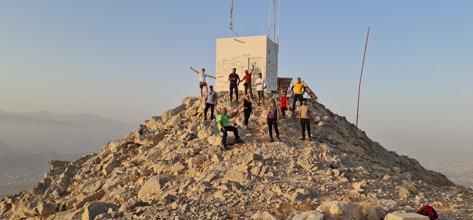
Whenever you drive from Al Nakheel area of Ras al Khaimah Highway E11 to E611, you can see a White building on the top of the mountain in front of you on the Jais mountain Range.
So I decided to play with the Ascent part and we decided to hike up via the Off-road that is constructed to service the Telecommunications facilities on the top of the mountain.
Our Ascent and descent path is Steep and controlled and you gain elevation quickly with some impressive views of Al Rams area.
It looks like a good off-roading area for a powerful 4X4 car, but some steep section will really test the car engine.
We didnt try off-roading as the road is rain damaged.
We hiked up the trail of Qarat Ad Dum from Al Rams area of Ras al Khaimah and via the functional steep, graded Off-road and then we explored towards the White Qarat building, our Summit.
The path is up and down and goes along on the mountain surface with uneven surface, loose rocks, some Scrambling and stiff rocky manageable walls.
As we reached our summit, we were fortunate to reach just in time for a beautiful Sunrise over the Hajar mountains.
After a well deserved rewarding rest, we hiked down via the same path.
There is no trail as such most of the time, but you can see some goat trail around.
Most of the time, you can see the Al Rams area, Saraya islands area from the heights and it is beautiful.
The parking area and the hike start point for tis trail is somewhere here.
25.854660, 56.025381
https://goo.gl/maps/jf6uwXUUWapJ5HTi6
This is a populated area, so be discreet while parking and dont block the graded roads of the houses in the village.
Overall, its a nice, short and interesting hike.
No Technical business and no big boulders.
Make sure you wear ankle support hiking boots and all other hiking related items and care. Hydration, Electrolytes, First Aid, Lighting, Shade and other essential concerns should be taken care of.
Parking Location:
Grade: Moderate
Base Village: Wadi Shah / Khamed
Range: Jebel Jais, Wadi Shah, Wadi Lahsa.
Download:

Qarat ad Dum Jebel Al Azir Peak summit

Terrain.

Terrain.

Terrain.

Range: Jebel Jais Mountain, Ras al Khaimah, UAE.

Range: Jebel Jais Mountain, Ras al Khaimah, UAE.

Range: Jebel Jais Mountain, Ras al Khaimah, UAE.

Range: Jebel Jais Mountain, Ras al Khaimah, UAE.


Leave a Reply