My Non Commercial and Non Profit Hiking Community friendly personal FB Page dedicated to UAE Hiking information and Trails.
https://www.facebook.com/Patricks-Hikes-101251445547970
Mebrah to Jebel Yibir Summit Loop. ( Part exploration )
Trail Stats:
| Distance: | 5 kms |
| Difficulty: | Moderate |
| Elevation gain: | 356 m |
| Elevation loss: | 356 m |
| Max elevation: | 1507 m |
| Min elevation: | 1261 m |
| Trail type: | One way |
| Moving time: | 1 hour 40 minutes |
Please refer the Yibir loop trail that I recorded for more pictures.
https://www.wikiloc.com/hiking-trails/jebel-yibir-summit-loop-part-exploration-168833319
If you followed my trail, referred my detailed text and if it helped you in achieving your goal or not, Kindly leave a comment / review on wikiloc post after your hike.
It will be helpful for fellow hikers to understand the trail and your inputs will be appreciated.
Generally people call the Mebrah mountain as Yibir, as it is drivable with a military installation on its summit and this summit is not accessible to the general public.
This trail recorded as one way till the summit of real Jebel Yibir.
You could return back the same way.
Jebel Yibir mountain peak at about 1500 meters above sea level is one of the seven top peaks in UAE. This peak is an independent peak within UAE with no sharing borderline with Oman such as Yabana, Harf Tila and Tafif mountains.
To hike this trail, you need to drive all the way to the top of Mebrah / Yibir mountain in Taween area.
The last section of about 6 Kms road is very steep and need a strong car.
The access road to the top of Mebrah mountain is recently reconstructed and of very good quality. You need a strong car to drive up and down due to steep road.
On the way, towards the top there is a RAK military gate. The guard will take car and EID details before allowing you in.
The permission to enter is purely to their discretion.
We parked here and started our hike.
25.649070, 56.121293
https://maps.app.goo.gl/6S1RemWPMcCYhH9M8
Please note that there are 2 trails that go parallelly to each other.
WE took the lower trail.
You can also take the upper trail which is recently remade.
It starts somewhere here.
25.650578, 56.123508
https://maps.app.goo.gl/6LKnLgoakP1PxEJg8
Within 150 meters of following your walk from the parking, you will be on a well visible established trail that will take you towards Durdur village in the left side and you walk further on the trail all the way.
In the midway, you will also see Jebel Yibir in the left side, there is no trail to go to its peak, its bit rough.
Please follow this trail, at about 3 kms point the trail turns left downwards to the base of Ybir.
Soon the trail continues towards Kanan village.
We took left connection with no visible trail and soon we were on stable ground with rocky terrain.
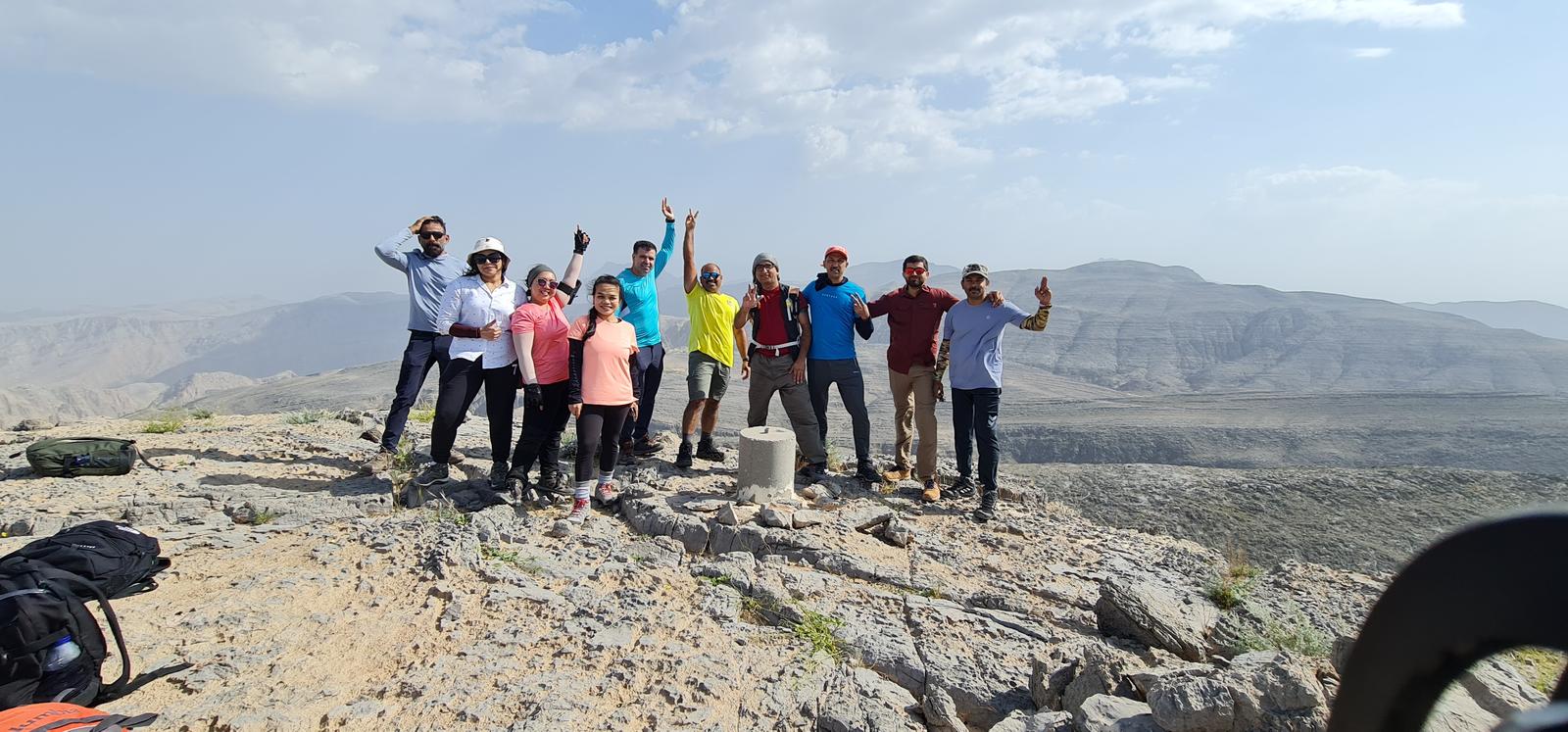
Once you are on the top, there are 3 summits that are false summits and you will reach the real Yibir summit of 1500 meters on the 4th high point.
You will also see a concrete foundation laid on the summit with a marker number on it.
From the summit, you have impressive views of Musandam peninsula mountains, Jebel Harf Tila, jebel Qihwi, Jebel Qadaah, Jebel Mebrah, Tallah Comstel tower, Kanan village and Samarat etc.
You can return back to the cars by the same way.
Parking Location:
Grade: Moderate
Base Village: Mebrah
Range: Yibir.
Download:

Summit

Summit

Terrain.

Summit.

View point.

View point

Trail.

Trail.


Leave a Reply