More details can also be found on wikiloc link below.
https://www.wikiloc.com/hiking-trails/oman-khasab-al-sayh-harim-to-jebel-jais-summit-102725803
My Non Commercial and Non Profit Hiking Community friendly personal FB Page dedicated to UAE Hiking information and Trails.
https://www.facebook.com/Patricks-Hikes-101251445547970
Khasab. Al Sayh/Harim to Jebel Jais Summit.
Trail Stats:
| Distance: | 6.5 kms |
| Difficulty: | Easy |
| Elevation gain: | 473 m |
| Elevation loss: | 473 m |
| Max elevation: | 1935 m |
| Min elevation: | 1500 m |
| Trail type: | Out and back |
| Moving time: | 2 hours 5 minutes |
Khasab. Al Sayh/Harim to Jebel Jais Summit.
Generally, hikers from UAE hiked upto the summit of Jebel Jais from various trails, about 6-7 public trails are available to reach the UAE side summit of Jais.
As the summit area is not fenced, hikers have walked another few hundred meters distance and reached the highest summit of Jais at 1935 meters, although it is illegal to do so I mean crossing the border crossing poles without any fences yet.
From UAE side, the highest point of Jais is at appx 1875 meters and it is known as Bil Ays.
Coming back to this hike, we were touring Musandam peninsula of Oman by road trip and we offroaded towards the Jebel Jais summit.
This offroading involves driving through Sayh Plateau, Jebel Harim access point, Wadi further down ( that connects to RAK ) and Rowdha / Lima villages.
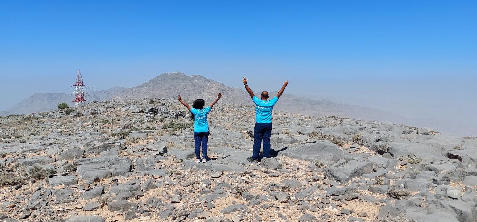
Once we were near Jebel Harim ( the mountain that you see in Oman side of Musandam with a big white globe, a military installation whenever you hike upper areas of Jebel Jais ), we decided to park our car closer to Jebel Jais and hike up to the true summit.
This time Legally !!! We had Passports stamped with Oman Visa !!
We parked somewhere here.
25.965515, 56.197635
https://goo.gl/maps/xCJ1KHqwYjUZckgt9
This trail is fairly well recorded, no Wadis to cross, no boulders to hop on, just a mountain surface to walk on steep at places. You will also encounter disused offroad that is part of previous power projects in the area.
The hike is pretty good with sports shoes too.
Please carry water and some nutrients as usual.
Most of the time you will be exposed to the sun.
We have hiked to the summit many times, but every time we visit, the views from the Jais summit are always impressive. Specially from the lower villages from the Cliff.
Be safe, prepare well, Do not over estimate and enjoy your moments in the middle of nowhere. Take back all your rubbish with you.
Parking Location:
Grade: Easy
Base Village: Al Sayh
Range: Jais.
Download:


Trail

Trail.

Trail.

Trail.

Trail

Trail

Leave a Reply