More details & pictures posted on wikiloc.
https://www.wikiloc.com/hiking-trails/wadi-ghalil-al-yafar-exploration-hike-ras-al-khaimah-wadi-lahsa-wadi-ghalil-al-yafar-jais-top-parki-205679624
My Non Commercial and Non Profit Hiking Community friendly personal FB Page dedicated to UAE Hiking information and Trails.
https://www.facebook.com/Patricks-Hikes-101251445547970
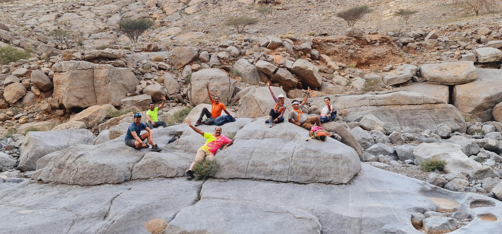
Wadi Ghalil Al Yafar Exploration Hike Ras al Khaimah.
(Wadi Lahsa – Wadi Ghalil al Yafar – Jais Top Parking)
Trail Stats:
| Distance: | 6.6 kms |
| Difficulty: | Difficult (Climbing) |
| Elevation gain: | 900 m |
| Elevation loss: | 60 m |
| Max elevation: | 1270 m |
| Min elevation: | 395 m |
| Trail type: | One way. |
| Moving time: | 4 hours 40 minutes |
Wadi Ghalil Al Yafar Exploration Hike Ras al Khaimah
Please Note:
I wouldn’t advise anyone to descend this wadi as per our ascent route, as some places can be tricky to climb down.
Best is to make vehicle management for starting and ending points and hike this as a one-way hike.
It’s a short distance high elevation gain valley with some nice climbs and lots of bouldering.
A rope may be required at about 2 places, which can also be navigated by alternative path but the area is more loose.
There is no trail whatsoever in this route, it is more of directional hike.
The elevation is gained fast over the rocky terrain and you will need good shoes, a 5 meter rope minimum for short persons and all other exploration hike preparations.
Please refer all waypoints and embedded pictures to understand the challenges of this hike.
Good for a short morning hike, the wall on the right side gave a good shade all the way up if you start early.
Most of the time you will have network, but it can also be intermittent.
Hiking poles will be beneficial.
I wouldn’t advise anyone to descend this wadi as per our route as some places can be tricky to climb down.
Best is to make vehicle management for starting and ending points and hike this as one way hike.
Starting point and parking here:
https://maps.app.goo.gl/igkyGXPwXsBd5Vm19
25.907139, 56.140501
Ending point and parking here:
https://maps.app.goo.gl/dwJefr8MeK24K4S5A
25.943151, 56.141983
Disclaimer:
𝘉𝘦 𝘴𝘢𝘧𝘦, 𝘱𝘳𝘦𝘱𝘢𝘳𝘦 𝘸𝘦𝘭𝘭, 𝘋𝘰 𝘯𝘰𝘵 𝘰𝘷𝘦𝘳 𝘦𝘴𝘵𝘪𝘮𝘢𝘵𝘦 𝘢𝘯𝘥 𝘦𝘯𝘫𝘰𝘺 𝘺𝘰𝘶𝘳 𝘮𝘰𝘮𝘦𝘯𝘵𝘴 𝘪𝘯 𝘵𝘩𝘦 𝘮𝘪𝘥𝘥𝘭𝘦 𝘰𝘧 𝘯𝘰𝘸𝘩𝘦𝘳𝘦. 𝘛𝘢𝘬𝘦 𝘣𝘢𝘤𝘬 𝘢𝘭𝘭 𝘺𝘰𝘶𝘳 𝘳𝘶𝘣𝘣𝘪𝘴𝘩 𝘸𝘪𝘵𝘩 𝘺𝘰𝘶. 𝘋𝘰 𝘕𝘰𝘵 𝘛𝘳𝘺 𝘈𝘯𝘺 𝘔𝘰𝘶𝘯𝘵𝘢𝘪𝘯 𝘏𝘪𝘬𝘦𝘴 𝘐𝘧 𝘠𝘰𝘶 𝘋𝘰 𝘕𝘰𝘵 𝘜𝘯𝘥𝘦𝘳𝘴𝘵𝘢𝘯𝘥 𝘛𝘩𝘦 𝘔𝘰𝘶𝘯𝘵𝘢𝘪𝘯 𝘛𝘦𝘳𝘳𝘢𝘪𝘯𝘴, 𝘋𝘢𝘯𝘨𝘦𝘳𝘴 𝘍𝘳𝘰𝘮 𝘞𝘪𝘭𝘥𝘭𝘪𝘧𝘦, 𝘍𝘪𝘳𝘴𝘵 𝘈𝘪𝘥, 𝘏𝘺𝘥𝘳𝘢𝘵𝘪𝘰𝘯 𝘈𝘯𝘥 𝘚𝘯𝘢𝘤𝘬𝘴, 𝘠𝘰𝘶𝘳 𝘖𝘸𝘯 𝘍𝘪𝘵𝘯𝘦𝘴𝘴, 𝘙𝘦𝘮𝘰𝘵𝘦 𝘈𝘤𝘵𝘪𝘷𝘪𝘵𝘺 𝘗𝘳𝘦𝘱𝘢𝘳𝘢𝘵𝘪𝘰𝘯𝘴, 𝘊𝘰𝘮𝘮𝘶𝘯𝘪𝘤𝘢𝘵𝘪𝘰𝘯 𝘛𝘰𝘰𝘭𝘴, 𝘔𝘰𝘶𝘯𝘵𝘢𝘪𝘯 𝘎𝘦𝘰𝘨𝘳𝘢𝘱𝘩𝘺, 𝘛𝘰𝘱𝘰𝘨𝘳𝘢𝘱𝘩𝘺, 𝘙𝘪𝘴𝘬 𝘍𝘢𝘤𝘵𝘰𝘳𝘴, 𝘏𝘚𝘌 𝘙𝘦𝘲𝘶𝘪𝘳𝘦𝘮𝘦𝘯𝘵𝘴, 𝘏𝘪𝘬𝘪𝘯𝘨 𝘙𝘪𝘴𝘬𝘴, 𝘍𝘪𝘵𝘯𝘦𝘴𝘴 𝘓𝘦𝘷𝘦𝘭 𝘖𝘧 𝘛𝘩𝘦 𝘎𝘳𝘰𝘶𝘱 𝘔𝘦𝘮𝘣𝘦𝘳𝘴. 𝘚𝘵𝘶𝘥𝘺 𝘈𝘭𝘭 𝘈𝘣𝘰𝘷𝘦 𝘔𝘢𝘵𝘵𝘦𝘳𝘴 𝘞𝘦𝘭𝘭 𝘉𝘦𝘧𝘰𝘳𝘦 𝘍𝘰𝘭𝘭𝘰𝘸𝘪𝘯𝘨 𝘈𝘯𝘺 𝘛𝘳𝘢𝘪𝘭𝘴 𝘛𝘩𝘢𝘵 𝘠𝘰𝘶 𝘍𝘪𝘯𝘥 𝘖𝘯𝘭𝘪𝘯𝘦. 𝘗𝘭𝘦𝘢𝘴𝘦 𝘋𝘰 𝘕𝘰𝘵 𝘖𝘷𝘦𝘳 𝘌𝘴𝘵𝘪𝘮𝘢𝘵𝘦 𝘠𝘰𝘶𝘳𝘴𝘦𝘭𝘧. 𝘉𝘦𝘵𝘵𝘦𝘳 𝘉𝘦 𝘚𝘢𝘧𝘦 𝘛𝘩𝘢𝘯 𝘗𝘶𝘵 𝘠𝘰𝘶𝘳𝘴𝘦𝘭𝘧 / 𝘎𝘳𝘰𝘶𝘱 𝘐𝘯 𝘋𝘢𝘯𝘨𝘦𝘳 𝘈𝘯𝘥 𝘙𝘦𝘨𝘳𝘦𝘵 𝘓𝘢𝘵𝘦𝘳. 𝘓𝘢𝘵𝘦𝘭𝘺 𝘞𝘦 𝘏𝘢𝘷𝘦 𝘚𝘦𝘦𝘯 𝘈 𝘓𝘰𝘵 𝘖𝘧 𝘜𝘯𝘸𝘢𝘯𝘵𝘦𝘥 𝘏𝘪𝘬𝘪𝘯𝘨 𝘐𝘯𝘤𝘪𝘥𝘦𝘯𝘵𝘴 𝘛𝘩𝘢𝘵 𝘊𝘰𝘶𝘭𝘥 𝘏𝘢𝘷𝘦 𝘉𝘦𝘦𝘯 𝘈𝘷𝘰𝘪𝘥𝘦𝘥 𝘞𝘪𝘵𝘩 𝘉𝘦𝘵𝘵𝘦𝘳 𝘗𝘳𝘦𝘱𝘢𝘳𝘢𝘵𝘪𝘰𝘯. 𝘞𝘪𝘴𝘩 𝘠𝘰𝘶 𝘈𝘭𝘭 𝘛𝘩𝘦 𝘉𝘦𝘴𝘵. 𝘞𝘪𝘬𝘪𝘭𝘰𝘤, 𝘖𝘯𝘭𝘺 𝘍𝘰𝘳 𝘙𝘦𝘧𝘦𝘳𝘦𝘯𝘤𝘦. 𝘛𝘩𝘦𝘳𝘦 𝘊𝘢𝘯 𝘉𝘦 𝘌𝘳𝘳𝘰𝘳𝘴 𝘖𝘯 𝘛𝘩𝘦 𝘎𝘗𝘚 𝘙𝘦𝘤𝘰𝘳𝘥𝘪𝘯𝘨 𝘋𝘶𝘦 𝘛𝘰 𝘎𝘗𝘚 𝘑𝘶𝘮𝘱𝘪𝘯𝘨 𝘐𝘯 𝘛𝘩𝘦 𝘞𝘢𝘥𝘪 𝘚𝘦𝘤𝘵𝘪𝘰𝘯𝘴 𝘰𝘳 𝘌𝘳𝘳𝘰𝘯𝘦𝘰𝘶𝘴 𝘙𝘦𝘤𝘰𝘳𝘥𝘪𝘯𝘨.
Parking Location:
Grade: Difficult
Base Village: Wadi Lahsa
Range: Jebel Jais
Download:


Trail

Trail

Trail


Trail

Trail.
Leave a Reply