
My Non Commercial and Non Profit Hiking Community friendly personal FB Page dedicated to UAE Hiking information and Trails.
https://www.facebook.com/Patricks-Hikes-101251445547970
Wadi Al Ghail / Ghayl Dam / Kalba Dam Twin Peak Hike (Hanging Garden view).
Trail Stats:
| Distance: | 9.1 kms |
| Difficulty: | Moderate+ |
| Elevation gain: | 380 m |
| Elevation loss: | 380 m |
| Max elevation: | 294 m |
| Min elevation: | 22 m |
| Trail type: | Loop |
| Moving time: | 2 hours 30 minutes |
Wadi Al Ghail / Ghayl Dam / Kalba Dam Twin Peak Hike (Hanging Garden view)
For those seeking an outdoor adventure, the Ghail Dam area offers two distinct trails nestled on opposing ends of the dam, connected by a well-trodden path encircling the lake.
If you followed my trail and my details provided have been helpful for you in your hiking journey, kindly leave a review on this post.
It helps other hikers and it will build a better hiking community. Thank you.
The rightward peak, with the dam as a backdrop, spans approximately 2km in elevation, while the alternate peak, coupled with the loop, extends to about 5.5km. Both peaks boast carefully crafted, man-made winding trails for an immersive hiking experience.
To commence your journey, input “Ghail Dam” or “Kalba Dam” into Google Maps.
We drove till here and parked here.
25.011694, 56.319165
https://maps.app.goo.gl/JbRgM3z1ZbUda3C58
Position yourself on the water-facing side of the dam structure, as direct access to the trails or lakeside is unavailable from the dam itself.
Please exercise caution during periods of high water or heavy rain, particularly when crossing at the first starting point.
We hiked up anti-clockwise, thus we reached the higher summit first.
Then you need to come down a bit to connect to the loop trail that takes you to the 2nd summit via a saddle and good views of a new manmade lake.
Overall a very visible safe trail and no chances of losing the way.
Still caution is needed as usual.
towards the very end section of the hike ( at Dam level ) the trail goes missing for about 150 meters and again gets visible.
Just follow general direction of the cars and along the bank of the Dam and you will find the trail.
For those craving breathtaking views, sunrise enthusiasts may revel in a picturesque dawn, although exposure to full sunlight is inevitable. Conversely, late afternoons provide welcome shade, setting the stage for captivating sunsets on certain evenings.
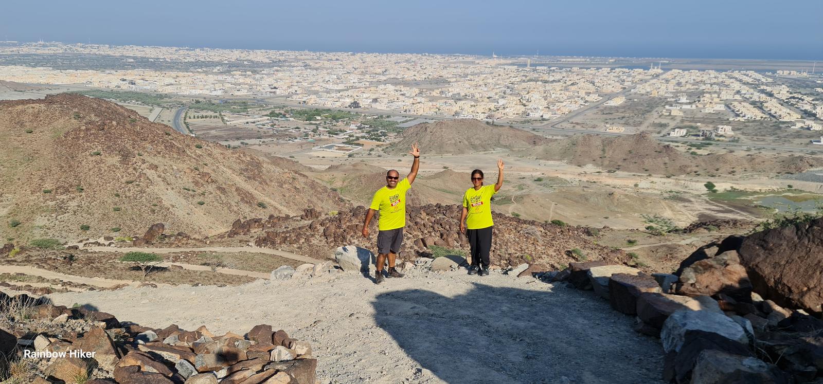
This is a straightforward and easily navigable trail, offering panoramic city and sea views on one side and a backdrop of majestic mountains on the other. Ideal for sunrise hikes along the seaside or sunset adventures overlooking the mountains, this trail features a manageable incline, making it perfect for cardio workouts.
Remember to bring an ample supply of water, and please help maintain the trail’s cleanliness, avoiding the unfortunate fate suffered by many others.
Accessible by any car, the initial rough path can be negotiated even by sedans, ensuring convenient parking at the trailhead. Once on the trail, various paths may unfold before you, yet rest assured that regardless of your chosen route, you will ultimately converge at the same point when completing the entire loop.
Parking Location:
Grade: Easy
Base Village: Al Ghayl
Range: Kalba Sharjah
Download:

Summit

Greenery

Trail.

Trail.

Trail.

Trail

Trail

Trail.


Leave a Reply